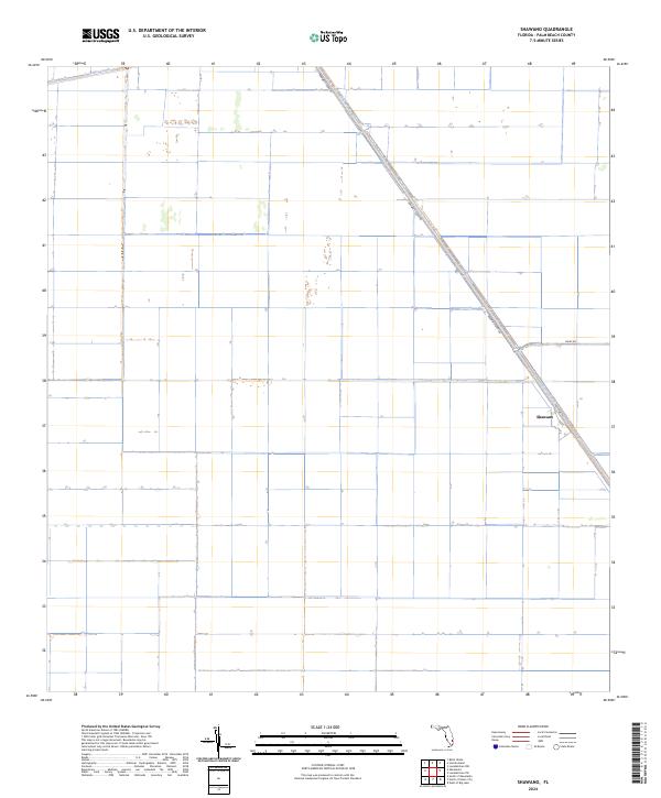
2024 Map of Shawano
USGS Topo · Published 2024About this map
Shawano sits at the intersection of agricultural transport and water management in the Florida Everglades. This landscape is defined by the massive engineering of the Hillsboro Canal and Bolles Canal, which provide the essential drainage and irrigation infrastructure for the region's expansive farming operations. The geometry of the land is strictly organized by the Public Land Survey System, with large tracts such as t44s r38e and t45s r38e subdivided by a grid of access roads. Major thoroughfares like Brown's Farm Rd and Co Hwy 827 follow the diagonal path of the canal, connecting the interior fields to the regional network. Small local arteries, including A St and Dairy Rd, reflect the localized infrastructure needed to manage this highly controlled environment.
Find a feature on this map
13 named features on this map. Tap any name to fly to it.
Don’t see what you’re looking for? This feature index may not catch every label — zoom into the map to look around manually.
Map Details
Editions of this 2024 Shawano Map
This is the sole edition of this map. No revisions or reprints were ever made.
Other maps of this area

1956 · West Palm Beach
USGS Topo · 1:250,000

1957 · West Palm Beach
USGS Topo · 1:250,000

1958 · West Palm Beach
USGS Topo · 1:250,000

1970 · Belle Glade
USGS Topo · 1:24,000

1970 · Okeelanta
USGS Topo · 1:24,000

1970 · Loxahatchee NW
USGS Topo · 1:24,000

1970 · Loxahatchee SW
USGS Topo · 1:24,000

1970 · Shawano
USGS Topo · 1:24,000

1970 · Sixmile Bend
USGS Topo · 1:24,000

1974 · Everglades 1 NW
USGS Topo · 1:24,000