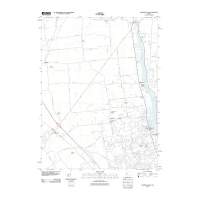
2010 Map of Shawnee Hills
USGS Topo · Published 2010About this map
The Scioto River corridor defines this portion of Central Ohio, where suburban expansion meets long-standing agricultural townships. In the early 21st century, the landscape shows a clear transition from the established settlements of Jerome and Watkins to the modern residential developments around Shawnee Hills. Local history is preserved in a high concentration of burial grounds, including the Oller Cemetery and White Cemetery near the river, as well as the Jerome Township Number 1 Cemetery. The infrastructure of the region is anchored by the O'Shaughnessy Dam, which contains the waters of the Golden Bear Reservoir. Aviation history is present through private facilities like Schrader Airstrip and Mitchell Airport, reflecting the area's mix of rural space and proximity to growing commercial hubs near New California.
Find a feature on this map
56 named features on this map. Tap any name to fly to it.
Don’t see what you’re looking for? This feature index may not catch every label — zoom into the map to look around manually.
Map Details
Editions of this 2010 Shawnee Hills Map
This is the sole edition of this map. No revisions or reprints were ever made.
Other maps of this area

1901 · Dublin
USGS Topo · 1:62,500

1903 · Dublin
USGS Topo · 1:62,500

1913 · Richwood
USGS Topo · 1:62,500

1915 · Richwood
USGS Topo · 1:62,500

1916 · Milford Center
USGS Topo · 1:62,500

1924 · Delaware
USGS Topo · 1:62,500

1925 · Delaware
USGS Topo · 1:62,500

1944 · Richwood
USGS Topo · 1:62,500

1944 · Milford Center
USGS Topo · 1:62,500

1944 · Delaware
USGS Topo · 1:62,500