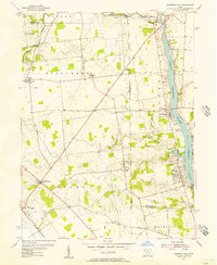
1954 Map of Shawnee Hills
USGS Topo · Published 1956About this map
O'Shaughnessy Reservoir dominates the eastern edge of this mid-1950s survey, marking a significant era of water management on the Scioto River north of Columbus. The presence of the O'Shaughnessy Dam and its adjacent Gaging Sta highlights the engineered landscape of Central Ohio during this period. West of the river, the terrain transitions into a grid of rural agricultural lands and small crossroads settlements such as Watkins, Jerome, and New California.
Find a feature on this map
42 named features on this map. Tap any name to fly to it.
Don’t see what you’re looking for? This feature index may not catch every label — zoom into the map to look around manually.
Map Details
Editions of this 1954 Shawnee Hills Map
This is the sole edition of this map. No revisions or reprints were ever made.
Other maps of this area

1901 · Dublin
USGS Topo · 1:62,500

1903 · Dublin
USGS Topo · 1:62,500

1913 · Richwood
USGS Topo · 1:62,500

1915 · Richwood
USGS Topo · 1:62,500

1916 · Milford Center
USGS Topo · 1:62,500

1924 · Delaware
USGS Topo · 1:62,500

1925 · Delaware
USGS Topo · 1:62,500

1944 · Richwood
USGS Topo · 1:62,500

1944 · Milford Center
USGS Topo · 1:62,500

1944 · Delaware
USGS Topo · 1:62,500