
1909 Map of Shawnee
USGS Topo · Published 1909About this map
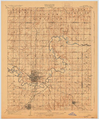
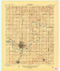
The North Fork Canadian River winds in tight oxbows through the heart of the Pottawatomie Co and Lincoln Co borderlands just years after Oklahoma's statehood. The city of Shawnee appears as a burgeoning rail hub, its grid dense with activity where the Chicago Rock Island and Pacific RR intersects with the Atchison Topeka and Santa Fe and the Missouri Kansas and Texas RR. Further south, Tecumseh remains a significant settlement, connected by the Shawnee Branch and the Rock Island and Interurban RR. Beyond the urban centers, the landscape is defined by the legacy of tribal lands, including an Indian Village and the Shawnee Mission. Local schools like Hagar School and Valley View School are scattered throughout the sections, alongside river crossings such as Mc Kenzie Ford and the Rock Crossing near Econtuchka.
Find a feature on this map
62 named features on this map. Tap any name to fly to it.
Don’t see what you’re looking for? This feature index may not catch every label — zoom into the map to look around manually.
Map Details
Editions of this 1909 Shawnee Map
Other maps of this area

1896 · Seminole and Prague
USGS Topo · 1:125,000

1898 · Purcell
USGS Topo · 1:125,000

1905 · Chandler
USGS Topo · 1:62,500

1907 · Chandler
USGS Topo · 1:62,500

1907 · Maud
USGS Topo · 1:62,500

1908 · Maud
USGS Topo · 1:62,500

1909 · Luther
USGS Topo · 1:62,500

1910 · McComb
USGS Topo · 1:62,500

1929 · Stroud
USGS Topo · 1:62,500

1930 · McLoud
USGS Topo · 1:62,500