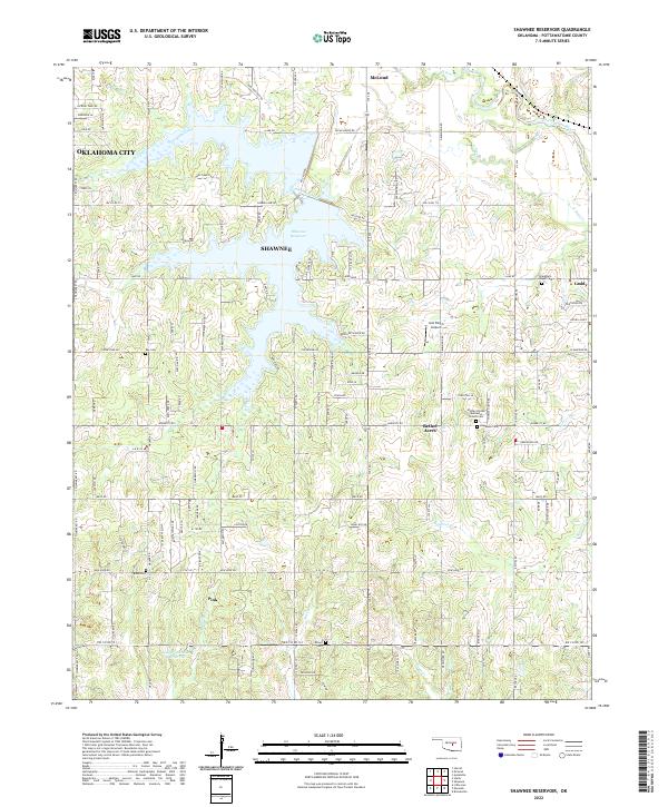
2022 Map of Shawnee Reservoir
USGS Topo · Published 2022About this map
Shawnee Reservoir dominates this central Oklahoma landscape, its irregular fingers reaching into the surrounding countryside between Shawnee and McLoud. The area exhibits a dense network of country roads and established rural communities including Bethel Acres and Pink. The North Canadian River skirts the northeastern corner, fed by smaller tributaries like South Deer Creek and Squirrel Cr. For those researching family history in Pottawatomie County, the map identifies several local burial grounds, such as Blackburn Chapel Cem and Hopewell Cem. The transition from the northern reaches of Oklahoma City to the more open spaces of the t9n r2e and t9n r3e townships shows the evolving settlement patterns of the early 21st century. Smaller water bodies like Longbranch Site 4 Reservoir and landmarks such as the Jazz Ranch Airport further distinguish this section of the state.
Find a feature on this map
53 named features on this map. Tap any name to fly to it.
Don’t see what you’re looking for? This feature index may not catch every label — zoom into the map to look around manually.
Map Details
Editions of this 2022 Shawnee Reservoir Map
This is the sole edition of this map. No revisions or reprints were ever made.
Other maps of this area

1896 · Seminole and Prague
USGS Topo · 1:125,000

1898 · Purcell
USGS Topo · 1:125,000

1907 · Maud
USGS Topo · 1:62,500

1908 · Maud
USGS Topo · 1:62,500

1909 · Shawnee
USGS Topo · 1:62,500

1910 · McComb
USGS Topo · 1:62,500

1930 · McLoud
USGS Topo · 1:62,500

1954 · Oklahoma City
USGS Topo · 1:250,000

1956 · Harrah
USGS Topo · 1:24,000
1956 · Stella
USGS Topo · 1:24,000