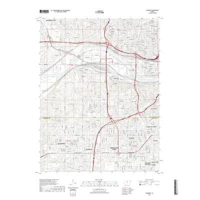
2018 Map of Shawnee
USGS Topo · Published 2018About this map
The Kansas River flows through this heavily developed corridor, marking the historic boundary between the neighborhoods of Kansas City and Argentine. This 2018 survey details a complex landscape of transportation and memory, where the Union Pacific RR Svc Rd and the Turner Memorial Bridge represent the industrial pulse of the region. The map is particularly dense with sites of genealogical importance, including the Huron Cem, Tensquatawa Burial Ground, and numerous smaller community grounds such as Shawnee Cem and Maple Hill Cem. These landmarks, alongside the winding path of Turkey Cr, reveal how the urban growth of Overland Park, Merriam, and Shawnee has integrated with the natural terrain of Badger Ridge and the older residential settlements that define the southern Wyandotte and northern Johnson County line.
Find a feature on this map
104 named features on this map. Tap any name to fly to it.
Don’t see what you’re looking for? This feature index may not catch every label — zoom into the map to look around manually.
Map Details
Editions of this 2018 Shawnee Map
This is the sole edition of this map. No revisions or reprints were ever made.
Other maps of this area

1887 · Olathe
USGS Topo · 1:125,000

1890 · Kansas City
USGS Topo · 1:125,000

1893 · Olathe
USGS Topo · 1:125,000

1894 · Kansas City
USGS Topo · 1:125,000

1934 · Bonner Springs
USGS Topo · 1:48,000

1934 · Grandview
USGS Topo · 1:24,000

1934 · Shawnee
USGS Topo · 1:24,000

1934 · Edwardsville
USGS Topo · 1:24,000

1934 · Wolcott
USGS Topo · 1:24,000

1935 · Olathe
USGS Topo · 1:24,000