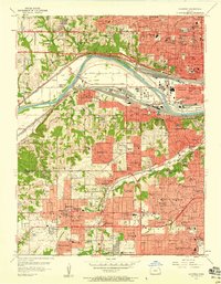
1957 Map of Shawnee
USGS Topo · Published 1958About this map
The Kansas River carves a path through this mid-century landscape, separating the industrial rail hubs of Argentine and Muncie from the burgeoning residential corridors of Johnson County. Heavy infrastructure dominates the riverbanks, where the Union Pacific and Kansas City Southern tracks meet the newly developed Kansas Turnpike. This period of rapid suburban expansion is visible in the dense network of schools and neighborhood names such as Kinney Heights, Highland Crest, and Cunningham Highlands.
Find a feature on this map
120 named features on this map. Tap any name to fly to it.
Don’t see what you’re looking for? This feature index may not catch every label — zoom into the map to look around manually.
Map Details
Editions of this 1957 Shawnee Map
This is the sole edition of this map. No revisions or reprints were ever made.
Other maps of this area

1887 · Olathe
USGS Topo · 1:125,000

1890 · Kansas City
USGS Topo · 1:125,000

1893 · Olathe
USGS Topo · 1:125,000

1894 · Kansas City
USGS Topo · 1:125,000

1934 · Bonner Springs
USGS Topo · 1:48,000

1934 · Grandview
USGS Topo · 1:24,000

1934 · Shawnee
USGS Topo · 1:24,000

1934 · Edwardsville
USGS Topo · 1:24,000

1934 · Wolcott
USGS Topo · 1:24,000

1935 · Olathe
USGS Topo · 1:24,000