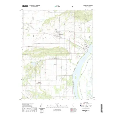
2021 Map of Shawneetown
USGS Topo · Published 2021About this map
Old Shawneetown and its successor settlement, Shawneetown, occupy a critical bend in the Ohio River where the landscape transitions from river bottomlands to the prominent Shawneetown Hills. This survey illustrates the distinct relocation of the town from its original riverfront site to higher ground, a shift driven by the area's history of flooding. The southern portion of the quadrangle is dominated by the Shawnee National Forest, encompassing significant elevations like Gold Hill and the drainage of the Saline River.
Find a feature on this map
69 named features on this map. Tap any name to fly to it.
Don’t see what you’re looking for? This feature index may not catch every label — zoom into the map to look around manually.
Map Details
Editions of this 2021 Shawneetown Map
This is the sole edition of this map. No revisions or reprints were ever made.
Other maps of this area

1905 · Eldorado
USGS Topo · 1:62,500

1905 · New Haven
USGS Topo · 1:62,500

1906 · New Haven
USGS Topo · 1:62,500

1906 · Eldorado
USGS Topo · 1:62,500

1916 · Shawneetown
USGS Topo · 1:62,500

1916 · Equality
USGS Topo · 1:62,500

1949 · Paducah
USGS Topo · 1:250,000

1949 · New Haven
USGS Topo · 1:62,500

1950 · Paducah
USGS Topo · 1:250,000
1953 · Wabash Island
USGS Topo · 1:24,000