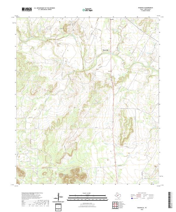
2022 Map of Shawville
USGS Topo · Published 2022About this map
The Colorado River carves a winding path through the northern half of this Coke County landscape, serving as a primary geographical anchor for the small community of Shawville and the southern edge of Bronte. The terrain transitions from riverbottom flats to significant elevations, most notably at Juniper Peak in the south and Cedar Mtn in the north. This modern topography documents the ranching and rural residential infrastructure of West Texas, defined by a network of local roads such as Abbott-Vaughn Rd, Rawlins Rd, and Ditmore Ln. Water remains a central theme in this arid environment, evidenced by the numerous named drainages like Kickapoo Creek, Liveoak Cr, and Mule Cr, which feed toward the main river channel or the localized W D Coleman Lake.
Find a feature on this map
34 named features on this map. Tap any name to fly to it.
Don’t see what you’re looking for? This feature index may not catch every label — zoom into the map to look around manually.
Map Details
Editions of this 2022 Shawville Map
This is the sole edition of this map. No revisions or reprints were ever made.
Other maps of this area

1891 · Hayrick
USGS Topo · 1:125,000

1894 · Hayrick
USGS Topo · 1:125,000

1921 · Bronte
USGS Topo · 1:31,680

1921 · Baker Flat
USGS Topo · 1:31,680

1921 · Maverick
USGS Topo · 1:31,680

1921 · Mays School
USGS Topo · 1:31,680

1954 · San Angelo
USGS Topo · 1:250,000

1957 · Miles
USGS Topo · 1:62,500

1957 · Harriet
USGS Topo · 1:62,500

1958 · San Angelo
USGS Topo · 1:250,000