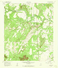
1961 Map of Shawville
USGS Topo · Published 1962About this map
Shawville sits as a central settlement in Coke County on this 1961 survey, situated along the Panhandle and Santa Fe railroad line. The landscape is defined by the winding course of the Colorado River, which is fed by several tributaries including Oak Creek and Double Barrel Creek. Significant industrial activity is evident in the northern portion of the map, where the Fort Chadbourne Oil Field is marked by numerous oil wells and associated infrastructure. The terrain rises sharply at landmarks such as Cedar Mtn and Juniper Peak, providing a clear record of the area's physical geography before modern development. Smaller resource extraction sites, including a Gravel Pit and Borrow Pit, dot the area near the river and rail corridor, illustrating the mid-century rural economy of West Texas.
Find a feature on this map
14 named features on this map. Tap any name to fly to it.
Don’t see what you’re looking for? This feature index may not catch every label — zoom into the map to look around manually.
Map Details
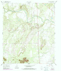
Editions of this 1961 Shawville Map
2 editions found
Other maps of this area

1891 · Hayrick
USGS Topo · 1:125,000

1894 · Hayrick
USGS Topo · 1:125,000

1921 · Bronte
USGS Topo · 1:31,680

1921 · Baker Flat
USGS Topo · 1:31,680

1921 · Maverick
USGS Topo · 1:31,680

1921 · Mays School
USGS Topo · 1:31,680

1954 · San Angelo
USGS Topo · 1:250,000

1957 · Miles
USGS Topo · 1:62,500

1957 · Harriet
USGS Topo · 1:62,500

1958 · San Angelo
USGS Topo · 1:250,000