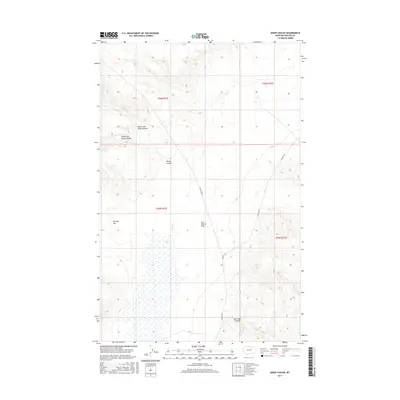
2017 Map of Sheep Coulee
USGS Topo · Published 2017About this map
Sun Prairie Flats dominates the central portion of this Phillips County landscape, characterized by the intricate drainage systems typical of the Northern Plains. The map details the convergence of the North Fork Sheep Coulee and South Fork Sheep Coulee, which carve through the terrain before reaching the broader Sheep Coulee. Further south, the distinct depression of The Big Sag sits west of Flat Cr, illustrating the complex local relief. Transportation in this section of the county is defined by sparse rural routes like Sun Prairie Rd and Content Rd, which follow the natural contours of the land. The presence of Box Elder Coulee in the southeast corner further highlights the erosion patterns that have shaped this open range land, providing essential detail for those studying the physical geography or historical land use of this Montana interior.
Find a feature on this map
14 named features on this map. Tap any name to fly to it.
Don’t see what you’re looking for? This feature index may not catch every label — zoom into the map to look around manually.
Map Details
Editions of this 2017 Sheep Coulee Map
This is the sole edition of this map. No revisions or reprints were ever made.
Other maps of this area

1954 · Jordan
USGS Topo · 1:250,000

1954 · Glasgow
USGS Topo · 1:250,000

1956 · Jordan
USGS Topo · 1:250,000

1957 · Glasgow
USGS Topo · 1:250,000

1958 · Glasgow
USGS Topo · 1:250,000

1958 · Jordan
USGS Topo · 1:250,000

1964 · Jordan
USGS Topo · 1:250,000

1965 · Coal Mine Hill
USGS Topo · 1:24,000

1965 · Sun Prairie
USGS Topo · 1:24,000

1965 · Whitcomb Lake
USGS Topo · 1:24,000