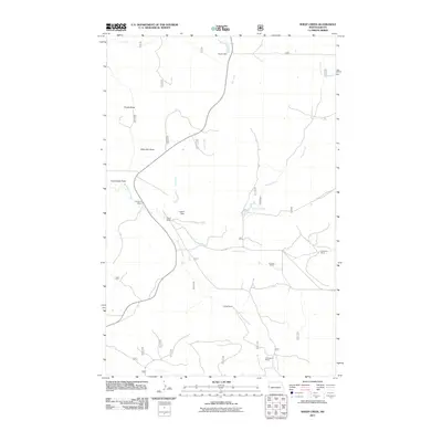
2011 Map of Sheep Creek
USGS Topo · Published 2011About this map
Named ranches and dry drainage patterns define this corner of McKenzie County as it appeared in the early 21st century. The landscape is marked by family operations such as the Indergard Ranch and Leland Ranch in the west, and the C Erstolen Ranch near Corral Creek to the east. These settlements are linked by a network of unimproved roads and the more established Co Rd 38, which cuts through the southern half of the quadrangle.
Find a feature on this map
19 named features on this map. Tap any name to fly to it.
Don’t see what you’re looking for? This feature index may not catch every label — zoom into the map to look around manually.
Map Details
Editions of this 2011 Sheep Creek Map
This is the sole edition of this map. No revisions or reprints were ever made.
Other maps of this area

1953 · Watford City
USGS Topo · 1:250,000

1957 · Watford City
USGS Topo · 1:250,000

1967 · Watford City
USGS Topo · 1:250,000

1972 · Horse Creek School
USGS Topo · 1:24,000

1972 · Moline School
USGS Topo · 1:24,000
1972 · Phillip Spring
USGS Topo · 1:24,000

1972 · Sheep Creek
USGS Topo · 1:24,000

1972 · Sather Lake
USGS Topo · 1:24,000
1972 · Burning Mine Butte
USGS Topo · 1:24,000
1974 · Squaw Gap
USGS Topo · 1:24,000