
1972 Map of Horse Creek School
USGS Topo · Published 1975About this map
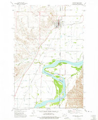
Horse Creek School serves as the central landmark for this rural McKenzie County landscape, situated amidst a complex network of drainages and coulees. During the early 1970s, the area's geography was defined by the winding paths of Horse Creek and Vanderhoof Coulee, where water management is evidenced by features like the Derudder Dam. The terrain is marked by numerous resource extraction points, with several locations simply labeled Well and a local Gravel Pit supporting the regional infrastructure. This map illustrates the transition of the North Dakota prairie into a more industrial landscape, with a significant Pipeline cutting through the western sections. The rural settlement pattern is sparse, with primary activity centered around the junctions of Cheney Creek and Alkali Creek, reflecting the essential relationship between water sources and land use in this part of the state.
Find a feature on this map
14 named features on this map. Tap any name to fly to it.
Don’t see what you’re looking for? This feature index may not catch every label — zoom into the map to look around manually.
Map Details
Editions of this 1972 Horse Creek School Map
This is the sole edition of this map. No revisions or reprints were ever made.
Other maps of this area

1909 · Glendive
USGS Topo · 1:250,000

1953 · Watford City
USGS Topo · 1:250,000

1954 · Glendive
USGS Topo · 1:250,000

1957 · Glendive
USGS Topo · 1:250,000

1957 · Watford City
USGS Topo · 1:250,000

1958 · Glendive
USGS Topo · 1:250,000

1966 · Sidney NE
USGS Topo · 1:24,000

1967 · Watford City
USGS Topo · 1:250,000
1972 · Fairview
USGS Topo · 1:24,000

1972 · Sidney SE
USGS Topo · 1:24,000