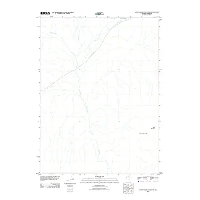
2012 Map of Sheep Creek Range NW
USGS Topo · Published 2012About this map
Wire Corral Ranch sits at the northern edge of this high-desert landscape in the Lander County portion of the Sheep Creek Range. The terrain is defined by a dendritic network of ephemeral drainages, including the prominent Rock Creek, which flows south to north across the center of the sheet. Travel through this area is largely facilitated by the Rock Creek Rd, a simple artery cutting diagonally toward the northern uplands. In the southeastern corner, the prominent peak of Black Mountain rises above the basin, while other watercourses like Antelope Creek and Sixmile Creek drain the western and northeastern slopes. This 2012 survey illustrates the sparse, ranch-oriented infrastructure common in modern Nevada's Great Basin, where land use remains focused on large-scale grazing and open space.
Find a feature on this map
7 named features on this map. Tap any name to fly to it.
Don’t see what you’re looking for? This feature index may not catch every label — zoom into the map to look around manually.
Map Details
Editions of this 2012 Sheep Creek Range NW Map
This is the sole edition of this map. No revisions or reprints were ever made.
Other maps of this area

1955 · McDermitt
USGS Topo · 1:250,000

1955 · Winnemucca
USGS Topo · 1:250,000

1958 · Winnemucca
USGS Topo · 1:250,000

1959 · McDermitt
USGS Topo · 1:250,000

1962 · Winnemucca
USGS Topo · 1:250,000

1965 · Izzenhood Gap
USGS Topo · 1:24,000

1965 · Sixmile Hill
USGS Topo · 1:24,000

1965 · Sheep Creek Range SW
USGS Topo · 1:24,000

1965 · Sheep Creek Range NE
USGS Topo · 1:24,000

1965 · Sheep Creek Range SE
USGS Topo · 1:24,000