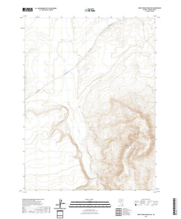
2021 Map of Sheep Creek Range NW
USGS Topo · Published 2021About this map
The high desert terrain of Lander County is defined here by the steep elevations of the Sheep Creek Range and the prominent peak of Black Mtn. This landscape is primarily shaped by seasonal drainage patterns, where Rock Cr, Antelope Cr, and Sixmile Cr cut through the arid topography. The map reveals a remote area largely organized by the Public Land Survey System, with the intersections of Township 35 and 36 North crossing Ranges 46 and 47 East.
Find a feature on this map
10 named features on this map. Tap any name to fly to it.
Don’t see what you’re looking for? This feature index may not catch every label — zoom into the map to look around manually.
Map Details
Editions of this 2021 Sheep Creek Range NW Map
This is the sole edition of this map. No revisions or reprints were ever made.
Other maps of this area

1955 · McDermitt
USGS Topo · 1:250,000

1955 · Winnemucca
USGS Topo · 1:250,000

1958 · Winnemucca
USGS Topo · 1:250,000

1959 · McDermitt
USGS Topo · 1:250,000

1962 · Winnemucca
USGS Topo · 1:250,000

1965 · Izzenhood Gap
USGS Topo · 1:24,000

1965 · Sixmile Hill
USGS Topo · 1:24,000

1965 · Sheep Creek Range SW
USGS Topo · 1:24,000

1965 · Sheep Creek Range NE
USGS Topo · 1:24,000

1965 · Sheep Creek Range SE
USGS Topo · 1:24,000