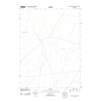
2012 Map of Sheep Creek Range SE
USGS Topo · Published 2012About this map
Sheep Creek Range dominates the western edge of this Nevada landscape, where the high desert terrain transitions into the broad expanse of Boulder Valley. The drainage pattern is defined by the convergence of several significant watercourses, primarily Rock Creek and Boulder Creek, which carve through the arid basin. This 2012 U.S. Geological Survey representation highlights the sparse infrastructure of the region, anchored by the winding path of Rock Creek Rd. The map illustrates a classic Great Basin environment where seasonal hydrography and topographical relief dictate the movement through the valley, offering a precise look at the land before further modern development or changes in land use occurred.
Find a feature on this map
5 named features on this map. Tap any name to fly to it.
Don’t see what you’re looking for? This feature index may not catch every label — zoom into the map to look around manually.
Map Details
Editions of this 2012 Sheep Creek Range SE Map
This is the sole edition of this map. No revisions or reprints were ever made.
Other maps of this area

1955 · Winnemucca
USGS Topo · 1:250,000

1957 · Dunphy
USGS Topo · 1:62,500

1957 · Beowawe
USGS Topo · 1:62,500

1958 · Winnemucca
USGS Topo · 1:250,000

1962 · Winnemucca
USGS Topo · 1:250,000

1965 · Sheep Creek Range SW
USGS Topo · 1:24,000

1965 · Sheep Creek Range NE
USGS Topo · 1:24,000

1965 · Sheep Creek Range SE
USGS Topo · 1:24,000

1965 · Sheep Creek Range NW
USGS Topo · 1:24,000

1968 · Rodeo Creek SW
USGS Topo · 1:24,000