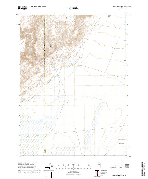
2021 Map of Sheep Creek Range SE
USGS Topo · Published 2021About this map
The Sheep Creek Range dominates the northwestern portion of this terrain, where steep slopes descend into the broad expanses of Boulder Valley and Boulder Flat. The landscape is defined by its drainage systems, notably Rock Cr and Boulder Cr, which transition from mountain canyons to the valley floor. Evidence of water management for local ranching or mining is seen in the Rock Cr Ditch at the base of the range. The boundary between Lander Co and Eureka Co bisects the map, illustrating the administrative divisions of this high-desert region. Most transit through the area is confined to Rock Creek Rd, which skirts the edge of the mountains, following the natural contours of the basin.
Find a feature on this map
17 named features on this map. Tap any name to fly to it.
Don’t see what you’re looking for? This feature index may not catch every label — zoom into the map to look around manually.
Map Details
Editions of this 2021 Sheep Creek Range SE Map
This is the sole edition of this map. No revisions or reprints were ever made.
Other maps of this area

1955 · Winnemucca
USGS Topo · 1:250,000

1957 · Dunphy
USGS Topo · 1:62,500

1957 · Beowawe
USGS Topo · 1:62,500

1958 · Winnemucca
USGS Topo · 1:250,000

1962 · Winnemucca
USGS Topo · 1:250,000

1965 · Sheep Creek Range SW
USGS Topo · 1:24,000

1965 · Sheep Creek Range NE
USGS Topo · 1:24,000

1965 · Sheep Creek Range SE
USGS Topo · 1:24,000

1965 · Sheep Creek Range NW
USGS Topo · 1:24,000

1968 · Rodeo Creek SW
USGS Topo · 1:24,000