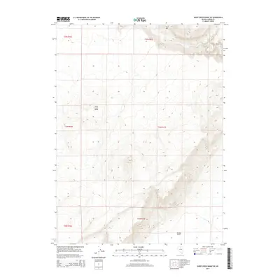
2014 Map of Sheep Creek Range SW
USGS Topo · Published 2014About this map
Sheep Creek Range dominates the western portion of this 2014 survey, displaying the characteristic north-south trending topography of central Nevada. The map captures a largely undeveloped landscape within the Great Basin, where dramatic elevation changes define the transition from high mountain peaks to the broad floor of Boulder Valley in the southeast. Significant landmarks like Black Mtn punctuate the ridgelines, while the seasonal course of Rock Cr cuts through the northern sections. This topographic study reflects the enduring isolation of this part of Lander County, where the land is primarily divided by the Public Land Survey System into townships like t34n r47e. The map serves as a detailed record of high-desert drainage patterns and terrain for researchers focused on the natural history or ranching boundaries of the region.
Find a feature on this map
10 named features on this map. Tap any name to fly to it.
Don’t see what you’re looking for? This feature index may not catch every label — zoom into the map to look around manually.
Map Details
Editions of this 2014 Sheep Creek Range SW Map
This is the sole edition of this map. No revisions or reprints were ever made.
Other maps of this area

1955 · Winnemucca
USGS Topo · 1:250,000

1957 · Dunphy
USGS Topo · 1:62,500

1957 · Battle Mountain
USGS Topo · 1:62,500

1958 · Winnemucca
USGS Topo · 1:250,000

1962 · Winnemucca
USGS Topo · 1:250,000

1965 · Izzenhood Gap
USGS Topo · 1:24,000

1965 · Sheep Creek Range SW
USGS Topo · 1:24,000

1965 · Sheep Creek Range NE
USGS Topo · 1:24,000

1965 · Sheep Creek Range SE
USGS Topo · 1:24,000

1965 · Sheep Creek Range NW
USGS Topo · 1:24,000