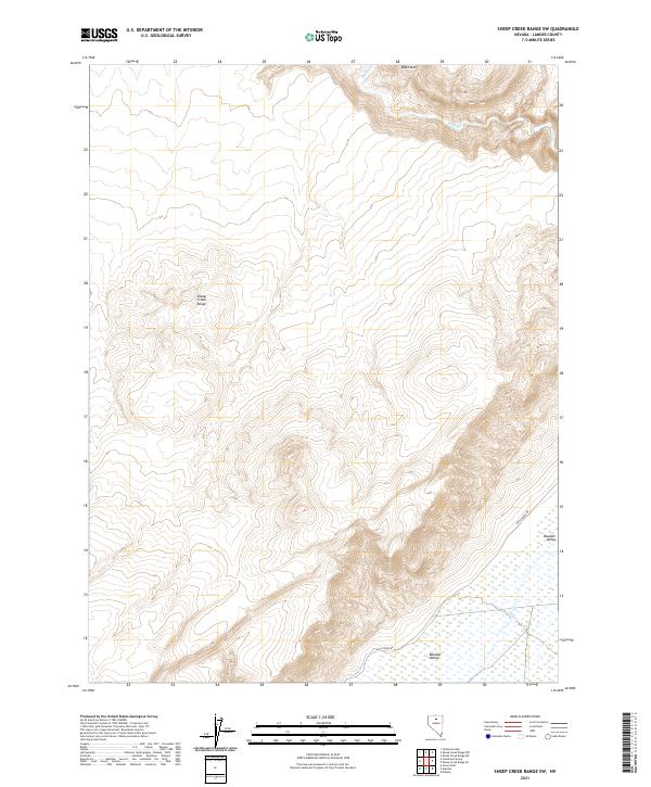
2021 Map of Sheep Creek Range SW
USGS Topo · Published 2021About this map
The Sheep Creek Range dominates the central landscape of this Lander County map, exhibiting a complex network of high ridges and deep drainage systems that define this part of the Great Basin. To the northeast, Black Mtn stands as a prominent high point, overlooking the winding path of Rock Cr. The terrain transitions sharply in the southeastern corner, where the high country gives way to the broad, flatter expanse of Boulder Valley. This shift from mountain to valley is marked by the presence of numerous wetland features at the base of the range, likely fed by the runoff from the higher elevations. The sparsely populated area is navigated primarily by Rock Creek Rd, which traces the eastern boundary of the mountains. The land is organized by the Public Land Survey System, shown through a grid of townships including t34n r47e and t35n r47e.
Find a feature on this map
11 named features on this map. Tap any name to fly to it.
Don’t see what you’re looking for? This feature index may not catch every label — zoom into the map to look around manually.
Map Details
Editions of this 2021 Sheep Creek Range SW Map
This is the sole edition of this map. No revisions or reprints were ever made.
Other maps of this area

1955 · Winnemucca
USGS Topo · 1:250,000

1957 · Dunphy
USGS Topo · 1:62,500

1957 · Battle Mountain
USGS Topo · 1:62,500

1958 · Winnemucca
USGS Topo · 1:250,000

1962 · Winnemucca
USGS Topo · 1:250,000

1965 · Izzenhood Gap
USGS Topo · 1:24,000

1965 · Sheep Creek Range SW
USGS Topo · 1:24,000

1965 · Sheep Creek Range NE
USGS Topo · 1:24,000

1965 · Sheep Creek Range SE
USGS Topo · 1:24,000

1965 · Sheep Creek Range NW
USGS Topo · 1:24,000