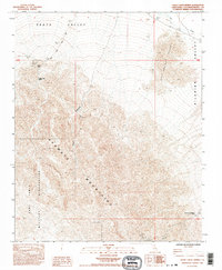
1985 Map of Sheep Creek Spring
USGS Topo · Published 1995About this map
The Avawatz Mountains dominate this high-desert landscape where the Fort Irwin Military Reservation meets the eastern reaches of Death Valley. This 1985 survey captures a territory defined by its scarce water sources and mining history, notably at the Sheep Cr Mine and the nearby Sheep Creek Spring. The presence of multiple unnamed Prospect and Prospects sites around the mountain slopes indicates the mid-century's ongoing geological exploration in San Bernardino County.
Find a feature on this map
15 named features on this map. Tap any name to fly to it.
Don’t see what you’re looking for? This feature index may not catch every label — zoom into the map to look around manually.
Map Details
Editions of this 1985 Sheep Creek Spring Map
2 editions found
Other maps of this area

1933 · Avawatz Mountains
USGS Topo · 1:250,000

1947 · Trona
USGS Topo · 1:250,000

1948 · Red Pass Lake
USGS Topo · 1:62,500

1948 · Trona
USGS Topo · 1:250,000

1948 · Avawatz Pass
USGS Topo · 1:62,500

1951 · Avawatz Pass
USGS Topo · 1:62,500

1951 · Red Pass Lake
USGS Topo · 1:62,500

1953 · Trona
USGS Topo · 1:250,000

1956 · Silurian Hills
USGS Topo · 1:62,500

1956 · Baker
USGS Topo · 1:62,500