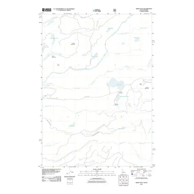
2011 Map of Sheep Falls
USGS Topo · Published 2011About this map
Fall River carves through the center of this Teton County landscape, where the waters of Boone Creek and Squirrel Creek join the drainage system. This high-country region is defined by a network of seasonal water sources and meadowlands, including the wide expanses of Putney Meadows and Squirrel Meadows. Human activity in this portion of the Forest Service lands is marked by water management and cattle ranching infrastructure, evidenced by the Indian Lake Dam and the Granite Creek Cow Camp.
Find a feature on this map
43 named features on this map. Tap any name to fly to it.
Don’t see what you’re looking for? This feature index may not catch every label — zoom into the map to look around manually.
Map Details
Editions of this 2011 Sheep Falls Map
This is the sole edition of this map. No revisions or reprints were ever made.
Other maps of this area

1886 · Shoshone
USGS Topo · 1:125,000

1888 · Shoshone
USGS Topo · 1:125,000

1895 · Shoshone
USGS Topo · 1:125,000

1899 · Grand Teton
USGS Topo · 1:125,000

1901 · Shoshone
USGS Topo · 1:125,000

1901 · Grand Teton
USGS Topo · 1:125,000

1908 · Shoshone
USGS Topo · 1:125,000

1911 · Shoshone
USGS Topo · 1:125,000

1955 · Ashton
USGS Topo · 1:250,000

1955 · Driggs
USGS Topo · 1:250,000