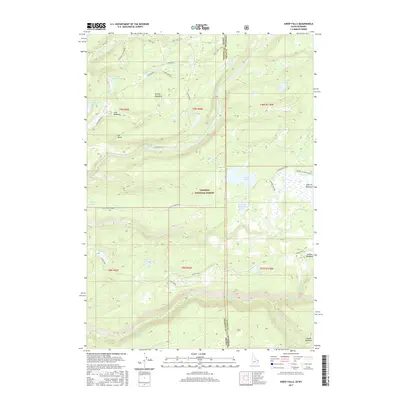
2017 Map of Sheep Falls
USGS Topo · Published 2017About this map
Targhee National Forest defines this high-elevation landscape along the Idaho and Wyoming border, where the headwaters of numerous creeks begin their descent. The map illustrates a complex drainage network including the Fall River and its many tributaries such as Boone Creek and Conant Creek. The terrain is marked by significant open spaces like Squirrel Meadows and the Wyoming Creek Breaks, which transition into water-rich basins containing Swan Lake, Indian Lake, and Widgit Lake. This 2017 edition documents the modern forest infrastructure, tracing the route of the Ashton-Flagg Ranch road and the Jackass Loop trail. The absence of major settlements highlights the remote character of this wilderness area near Cave Falls, preserved primarily for its natural features and hydrographic importance.
Find a feature on this map
47 named features on this map. Tap any name to fly to it.
Don’t see what you’re looking for? This feature index may not catch every label — zoom into the map to look around manually.
Map Details
Editions of this 2017 Sheep Falls Map
This is the sole edition of this map. No revisions or reprints were ever made.
Other maps of this area

1886 · Shoshone
USGS Topo · 1:125,000

1888 · Shoshone
USGS Topo · 1:125,000

1895 · Shoshone
USGS Topo · 1:125,000

1899 · Grand Teton
USGS Topo · 1:125,000

1901 · Shoshone
USGS Topo · 1:125,000

1901 · Grand Teton
USGS Topo · 1:125,000

1908 · Shoshone
USGS Topo · 1:125,000

1911 · Shoshone
USGS Topo · 1:125,000

1955 · Ashton
USGS Topo · 1:250,000

1955 · Driggs
USGS Topo · 1:250,000