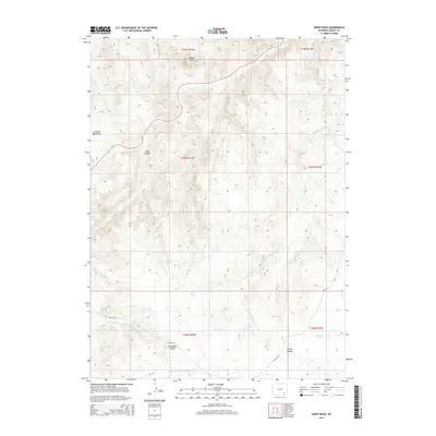
2015 Map of Sheep Rock
USGS Topo · Published 2015About this map
Laramie Mountains terrain dominates this portion of Albany County, where high ridges and deep drainages define the landscape. The prominent landform of Sheep Rock stands at the northern edge of the survey, overlooking a complex network of waterways including N Sybille Cr and Middle Sybille Cr. This area is characterized by significant vertical relief, with several prominent canyons cutting through the highlands, most notably Long Canyon, Plumbago Canyon, and Timber Canyon. Access through this remote high-country terrain is primary maintained via Sybille Rd, which follows the natural contours near Plumbago Cr. The map illustrates a high-elevation environment where seasonal drainages like Bear Cr and Spring Cr have carved the underlying geology over time.
Find a feature on this map
17 named features on this map. Tap any name to fly to it.
Don’t see what you’re looking for? This feature index may not catch every label — zoom into the map to look around manually.
Map Details
Editions of this 2015 Sheep Rock Map
This is the sole edition of this map. No revisions or reprints were ever made.
Other maps of this area

1954 · Cheyenne
USGS Topo · 1:250,000

1955 · Poe Mountain
USGS Topo · 1:24,000

1955 · Bosler SE
USGS Topo · 1:24,000

1955 · Bluegrass Wells
USGS Topo · 1:24,000

1955 · Sybille Springs
USGS Topo · 1:24,000

1955 · Indian Guide
USGS Topo · 1:24,000

1955 · Guide Rock
USGS Topo · 1:24,000

1955 · Baldy Mountain
USGS Topo · 1:24,000

1955 · Sheep Rock
USGS Topo · 1:24,000

1955 · Goat Mountain
USGS Topo · 1:24,000