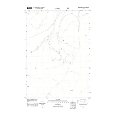
2011 Map of Sheephorn Peak
USGS Topo · Published 2011About this map
Sheephorn Peak and Rocky Peak anchor this high-elevation landscape within the Salmon-Challis National Forest during the early 21st century. The map reveals a complex network of alpine drainages, where the Big Timber Creek and its tributaries, such as Rocky Creek and Alder Creek, carve through the mountainous terrain of Lemhi County. In the north, Milk Creek and the North Fork Little Timber Creek define the watershed patterns. Human presence is limited to remote access routes like the Swan Basin Rd and Big Timber Creek Rd, which provide passage into the Swan Basin. This survey documents the area's topographical character, from the prominence of Leadore Hill to the remote Junction Peak, providing a clear view of the wilderness before subsequent forest service management shifts or environmental changes.
Find a feature on this map
18 named features on this map. Tap any name to fly to it.
Don’t see what you’re looking for? This feature index may not catch every label — zoom into the map to look around manually.
Map Details
Editions of this 2011 Sheephorn Peak Map
This is the sole edition of this map. No revisions or reprints were ever made.
Other maps of this area

1935 · Borah Peak
USGS Topo · 1:125,000

1938 · Borah Peak
USGS Topo · 1:125,000

1955 · Dubois
USGS Topo · 1:250,000

1956 · Leadore
USGS Topo · 1:62,500

1956 · Patterson
USGS Topo · 1:62,500

1956 · Donkey Hills
USGS Topo · 1:62,500

1957 · Gilmore
USGS Topo · 1:62,500

1958 · Dubois
USGS Topo · 1:250,000

1980 · Leadore
USGS Topo · 1:100,000

1987 · Gilmore
USGS Topo · 1:24,000