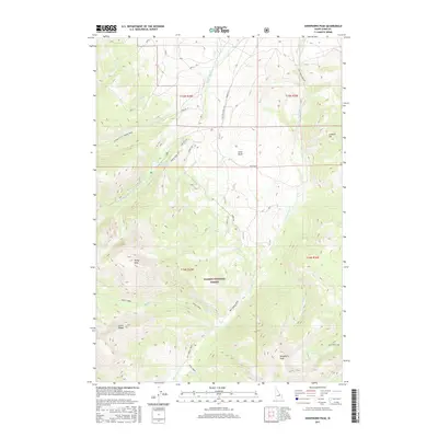
2017 Map of Sheephorn Peak
USGS Topo · Published 2017About this map
The high ridges of the Lemhi Range dominate this portion of the Salmon National Forest, where the complex drainage systems of the Little and Big Timber creeks define the high-altitude landscape. In the northern reaches, Stone Reservoir sits near the headwaters of the Middle Fork Little Timber Cr, while further south, the prominence of Sheephorn Peak rises near the isolated Nez Perce Lake. The map details an extensive network of forest access routes, including the Big Timber Creek Rd and numerous spurs like Spr B and Spr K, which provide passage through the steep terrain. This area, marked by topographical landmarks such as Rocky Peak and Leadore Hill, illustrates the 21st-century management of remote timber and watershed resources in Lemhi County.
Find a feature on this map
42 named features on this map. Tap any name to fly to it.
Don’t see what you’re looking for? This feature index may not catch every label — zoom into the map to look around manually.
Map Details
Editions of this 2017 Sheephorn Peak Map
This is the sole edition of this map. No revisions or reprints were ever made.
Other maps of this area

1935 · Borah Peak
USGS Topo · 1:125,000

1938 · Borah Peak
USGS Topo · 1:125,000

1955 · Dubois
USGS Topo · 1:250,000

1956 · Leadore
USGS Topo · 1:62,500

1956 · Patterson
USGS Topo · 1:62,500

1956 · Donkey Hills
USGS Topo · 1:62,500

1957 · Gilmore
USGS Topo · 1:62,500

1958 · Dubois
USGS Topo · 1:250,000

1980 · Leadore
USGS Topo · 1:100,000

1987 · Gilmore
USGS Topo · 1:24,000