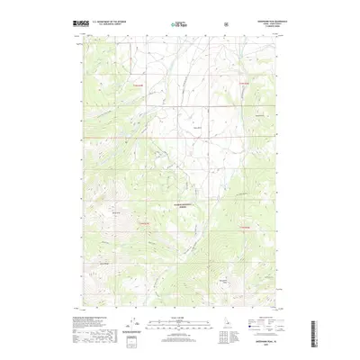
2020 Map of Sheephorn Peak
USGS Topo · Published 2020About this map
The high ridges of the Lemhi Range dominate this portion of the Salmon National Forest, where steep drainages and alpine peaks define the high-altitude landscape. Rising to prominent summits like Sheephorn Peak and Rocky Peak, the terrain is carved by a complex network of waterways, including Big Timber Creek and the Middle Fork Little Timber Creek. These streams flow through deep basins such as Swan Basin, eventually descending toward the valley floor near Leadore Hill.
Find a feature on this map
49 named features on this map. Tap any name to fly to it.
Don’t see what you’re looking for? This feature index may not catch every label — zoom into the map to look around manually.
Map Details
Editions of this 2020 Sheephorn Peak Map
This is the sole edition of this map. No revisions or reprints were ever made.
Other maps of this area

1935 · Borah Peak
USGS Topo · 1:125,000

1938 · Borah Peak
USGS Topo · 1:125,000

1955 · Dubois
USGS Topo · 1:250,000

1956 · Leadore
USGS Topo · 1:62,500

1956 · Patterson
USGS Topo · 1:62,500

1956 · Donkey Hills
USGS Topo · 1:62,500

1957 · Gilmore
USGS Topo · 1:62,500

1958 · Dubois
USGS Topo · 1:250,000

1980 · Leadore
USGS Topo · 1:100,000

1987 · Gilmore
USGS Topo · 1:24,000