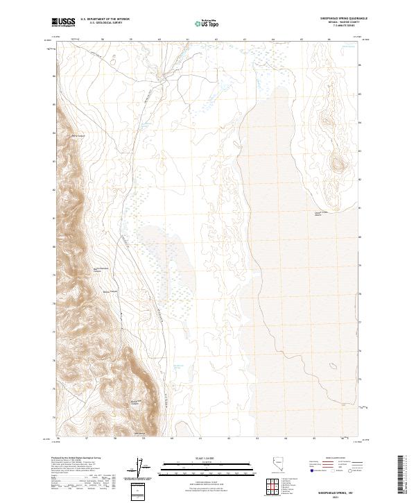
2021 Map of Sheepshead Spring
USGS Topo · Published 2021About this map
The Smoke Creek Desert dominates the eastern reaches of this high-desert landscape in Washoe County, where the arid basin floor meets the rising elevations of the Sand Range. Vital water sources appear as isolated points across the terrain, including Sheepshead Spring and Buckbrush Spring, which historically served as critical landmarks for travelers and ranching operations in this part of northern Nevada. The western portion of the sheet is defined by complex topography, carved by Maria Canyon, Black Diamond Canyon, and Willow Canyon. Transportation is limited to rugged corridors like Surprise Valley Rd and Smoke Creek Rd, tracing the edges of the desert and following the intermittent flow of Smoke Cr. This map documents a sparsely settled region where the natural geography of springs and canyons dictates the movement of people and livestock.
Find a feature on this map
16 named features on this map. Tap any name to fly to it.
Don’t see what you’re looking for? This feature index may not catch every label — zoom into the map to look around manually.
Map Details
Editions of this 2021 Sheepshead Spring Map
This is the sole edition of this map. No revisions or reprints were ever made.
Other maps of this area

1886 · Granite Range
USGS Topo · 1:250,000

1894 · Granite Range
USGS Topo · 1:250,000

1955 · Lovelock
USGS Topo · 1:250,000

1959 · Lovelock
USGS Topo · 1:250,000

1965 · Fox Range
USGS Topo · 1:62,500

1980 · Salt Marsh
USGS Topo · 1:24,000
1980 · Red Rock Canyon
USGS Topo · 1:24,000
1980 · Parker Canyon
USGS Topo · 1:24,000
1980 · Sand Pass
USGS Topo · 1:24,000

1980 · Hog Spring
USGS Topo · 1:24,000