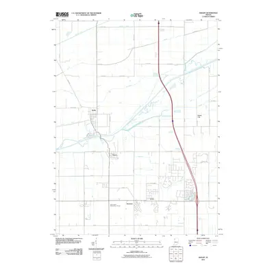
2010 Map of Shelby
USGS Topo · Published 2010About this map
The Kankakee River winds through this northwestern Indiana landscape, defining the boundary between Lake and Newton Counties near the settlements of Shelby and Thayer. This 2010 survey illustrates a highly engineered environment where natural waterways are supplemented by an extensive network of drainage features, including the Singleton Ditch, Vannatti Ditch, and Otis-Boyle Ditch. These ditches reflect the long-term reclamation of the Kankakee Marsh for agricultural use, a process that transformed the region's hydrology and land use patterns over the preceding century.
Find a feature on this map
49 named features on this map. Tap any name to fly to it.
Don’t see what you’re looking for? This feature index may not catch every label — zoom into the map to look around manually.
Map Details
Editions of this 2010 Shelby Map
This is the sole edition of this map. No revisions or reprints were ever made.
Other maps of this area

1953 · Leroy
USGS Topo · 1:24,000

1953 · Hebron
USGS Topo · 1:24,000

1953 · Lowell
USGS Topo · 1:24,000

1953 · Chicago
USGS Topo · 1:250,000

1957 · Chicago
USGS Topo · 1:250,000

1957 · DeMotte
USGS Topo · 1:24,000

1959 · Schneider
USGS Topo · 1:24,000

1959 · Shelby
USGS Topo · 1:24,000

1962 · Parr
USGS Topo · 1:24,000
1962 · Fair Oaks
USGS Topo · 1:24,000