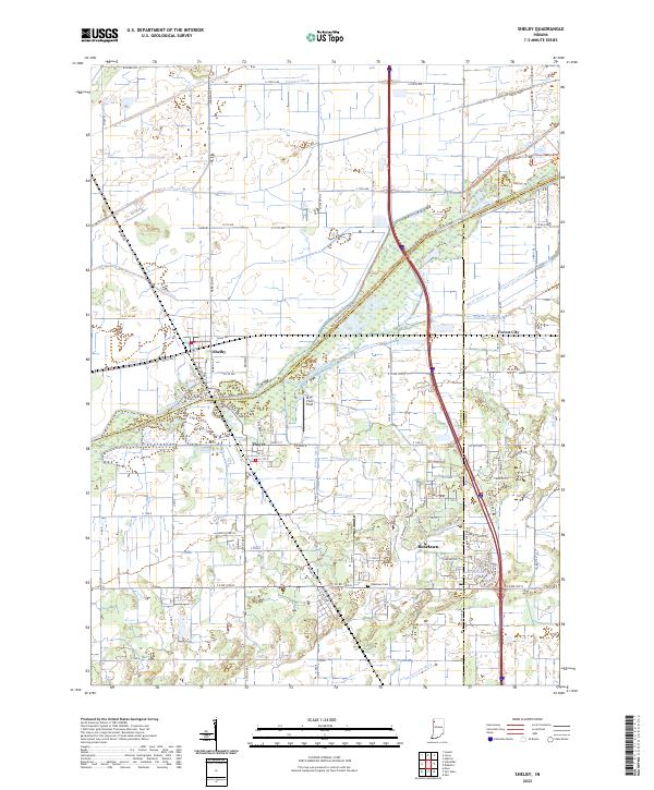
2022 Map of Shelby
USGS Topo · Published 2022About this map
The Kankakee River defines the central character of this Northwest Indiana landscape, acting as the boundary where Lake, Newton, and Jasper counties converge. The drainage of the historic Kankakee Marsh is evident in the dense network of man-made waterways, including the Singleton Ditch, Vannatti Ditch, and Brown Ditch, which have fundamentally reshaped the local topography for agriculture. Settlement centers are clustered along these reclaimed lands, with Shelby and Thayer situated near the riverbanks while Roselawn serves as a southern hub. Local history is anchored by sites such as the Roselawn Cem and the small airfield at River View Field. The map also captures the path of Monon Rd, a name echoing the region's deep connection to the historic Monon Railroad line that once served these communities.
Find a feature on this map
93 named features on this map. Tap any name to fly to it.
Don’t see what you’re looking for? This feature index may not catch every label — zoom into the map to look around manually.
Map Details
Editions of this 2022 Shelby Map
This is the sole edition of this map. No revisions or reprints were ever made.
Other maps of this area

1953 · Leroy
USGS Topo · 1:24,000

1953 · Hebron
USGS Topo · 1:24,000

1953 · Lowell
USGS Topo · 1:24,000

1953 · Chicago
USGS Topo · 1:250,000

1957 · Chicago
USGS Topo · 1:250,000

1957 · DeMotte
USGS Topo · 1:24,000

1959 · Schneider
USGS Topo · 1:24,000

1959 · Shelby
USGS Topo · 1:24,000

1962 · Parr
USGS Topo · 1:24,000
1962 · Fair Oaks
USGS Topo · 1:24,000