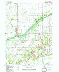
1992 Map of Shelby
USGS Topo · Published 1992About this map
The Kankakee River corridor defines the landscape of this northwestern Indiana region, where the historic marshlands of Eagle Creek Marsh have been extensively managed through an intricate system of drainage channels. Waterways like Vannatti Ditch, Singleton Ditch, and Tully Ditch illustrate the long-term engineering effort to reclaim the surrounding wetlands for agricultural and residential use. The settlement of Shelby serves as a primary local hub, positioned near the intersection of the river and the Monon RR. Further south, the community of Roselawn and the smaller enclave of Thayer provide a look at the mid-20th century development patterns in Lake and Newton Counties. The presence of Roselawn Cem, First Baptist Ch, and Victory Ch offers vital touchpoints for genealogists tracing family roots in this corner of the Kankakee valley.
Find a feature on this map
44 named features on this map. Tap any name to fly to it.
Don’t see what you’re looking for? This feature index may not catch every label — zoom into the map to look around manually.
Map Details
Editions of this 1992 Shelby Map
This is the sole edition of this map. No revisions or reprints were ever made.
Other maps of this area

1953 · Leroy
USGS Topo · 1:24,000

1953 · Hebron
USGS Topo · 1:24,000

1953 · Lowell
USGS Topo · 1:24,000

1953 · Chicago
USGS Topo · 1:250,000

1957 · Chicago
USGS Topo · 1:250,000

1957 · DeMotte
USGS Topo · 1:24,000

1959 · Schneider
USGS Topo · 1:24,000

1959 · Shelby
USGS Topo · 1:24,000

1962 · Parr
USGS Topo · 1:24,000
1962 · Fair Oaks
USGS Topo · 1:24,000