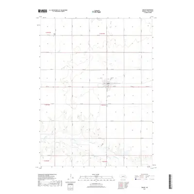
2017 Map of Shelby
USGS Topo · Published 2017About this map
Shelby serves as the central hub of this Polk County landscape, where the residential street grid meets the expansive agricultural sections of the Nebraska plains. The village is anchored by Graceland Cem at its northern edge, while the surrounding countryside preserves several historic focal points for local genealogy. The distribution of Wesley Chapel Cem, Palo Cem, and Thelen Cem across the township lines indicates the early settlement patterns of rural families who established independent community sites far from the main town center.
Find a feature on this map
36 named features on this map. Tap any name to fly to it.
Don’t see what you’re looking for? This feature index may not catch every label — zoom into the map to look around manually.
Map Details
Editions of this 2017 Shelby Map
This is the sole edition of this map. No revisions or reprints were ever made.
Other maps of this area

1896 · Stromsburg
USGS Topo · 1:125,000

1899 · David City
USGS Topo · 1:125,000

1955 · Fremont
USGS Topo · 1:250,000

1957 · Fremont
USGS Topo · 1:250,000

1958 · Fremont
USGS Topo · 1:250,000

1958 · Columbus SW
USGS Topo · 1:24,000

1958 · Silver Creek SE
USGS Topo · 1:24,000

1958 · Columbus SE
USGS Topo · 1:24,000
1965 · Stromsburg
USGS Topo · 1:24,000
1965 · Osceola
USGS Topo · 1:24,000