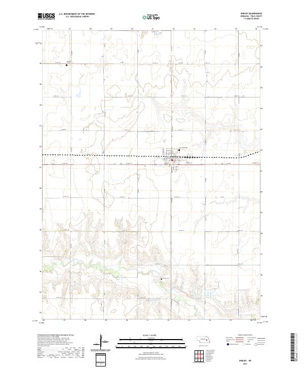
2021 Map of Shelby
USGS Topo · Published 2021About this map
Shelby serves as the central hub of this agricultural landscape in Polk County, situated along a grid of section-line roads and rural routes. The town’s spatial organization is defined by residential streets like Walnut St and Park St, which contrast with the surrounding vast townships such as t14n r1w and t15n r1w. This area is shaped by the winding path of the Big Blue River and the nearby Thelen Reservoir, which provide essential water resources for the region's farming heritage.
Find a feature on this map
38 named features on this map. Tap any name to fly to it.
Don’t see what you’re looking for? This feature index may not catch every label — zoom into the map to look around manually.
Map Details
Editions of this 2021 Shelby Map
This is the sole edition of this map. No revisions or reprints were ever made.
Other maps of this area

1896 · Stromsburg
USGS Topo · 1:125,000

1899 · David City
USGS Topo · 1:125,000

1955 · Fremont
USGS Topo · 1:250,000

1957 · Fremont
USGS Topo · 1:250,000

1958 · Fremont
USGS Topo · 1:250,000

1958 · Columbus SW
USGS Topo · 1:24,000

1958 · Silver Creek SE
USGS Topo · 1:24,000

1958 · Columbus SE
USGS Topo · 1:24,000
1965 · Stromsburg
USGS Topo · 1:24,000
1965 · Osceola
USGS Topo · 1:24,000