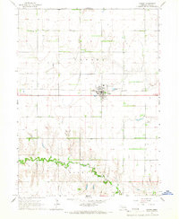
1965 Map of Shelby
USGS Topo · Published 1967About this map
The Union Pacific railroad and the Big Blue River define the agricultural landscape of this Polk County region in the mid-1960s. The town of Shelby serves as the central hub, situated along the rail line and the junction of several routes, including State Highway 76 and Highway 92. The mapping detail captures the transition from the flat, sectioned prairie in the north to the more complex topography surrounding the river valley in the south, particularly near the Hackberry and Cañada areas.
Find a feature on this map
15 named features on this map. Tap any name to fly to it.
Don’t see what you’re looking for? This feature index may not catch every label — zoom into the map to look around manually.
Map Details
Editions of this 1965 Shelby Map
This is the sole edition of this map. No revisions or reprints were ever made.
Other maps of this area

1896 · Stromsburg
USGS Topo · 1:125,000

1899 · David City
USGS Topo · 1:125,000

1955 · Fremont
USGS Topo · 1:250,000

1957 · Fremont
USGS Topo · 1:250,000

1958 · Fremont
USGS Topo · 1:250,000

1958 · Columbus SW
USGS Topo · 1:24,000

1958 · Silver Creek SE
USGS Topo · 1:24,000

1958 · Columbus SE
USGS Topo · 1:24,000
1965 · Stromsburg
USGS Topo · 1:24,000
1965 · Osceola
USGS Topo · 1:24,000