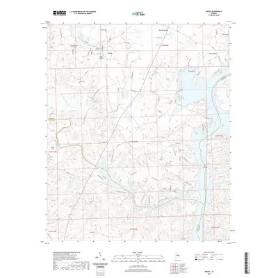
2020 Map of Shelby
USGS Topo · Published 2020About this map
Shelby sits at the heart of this landscape, where the convergence of the Shelby, Chilton, and Coosa County lines creates a complex geography of rural communities and water-driven landforms. The eastern boundary is defined by the expansive Lay Lake, which follows the ancient river path through The Narrows and around Turtle Point. This modern survey illustrates how topographic features like Kelley Mtn and Sawyer Cove have influenced the local road network, including the evocative Egg and Butter Rd. Genealogy researchers will find several documented burial grounds, including the Old Shelby Cem, the Shelby Garden of Rest, and the Brasher Cem, providing specific locations for family history work. The presence of Kewahatchie Spring near Kewahatchie highlights the enduring importance of natural water sources in this part of Alabama.
Find a feature on this map
105 named features on this map. Tap any name to fly to it.
Don’t see what you’re looking for? This feature index may not catch every label — zoom into the map to look around manually.
Map Details
Editions of this 2020 Shelby Map
This is the sole edition of this map. No revisions or reprints were ever made.
Other maps of this area

1890 · Bessemer
USGS Topo · 1:125,000

1890 · Talladega
USGS Topo · 1:125,000

1891 · Clanton
USGS Topo · 1:125,000

1892 · Talladega
USGS Topo · 1:125,000

1892 · Bessemer
USGS Topo · 1:125,000

1901 · Wetumpka
USGS Topo · 1:125,000

1903 · Wetumpka
USGS Topo · 1:125,000

1909 · Columbiana
USGS Topo · 1:62,500

1911 · Columbiana
USGS Topo · 1:62,500

1915 · Gantts Quarry
USGS Topo · 1:48,000