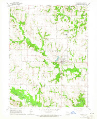
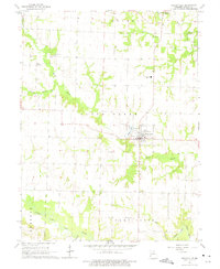
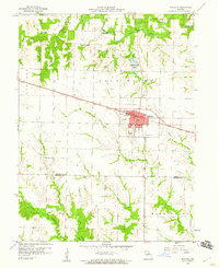
1964 Map of Shelbyville
USGS Topo · Published 1965About this map
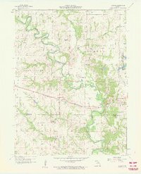
Shelbyville serves as the central hub for this mid-1960s agricultural region, situated south of the historic community of Bethel. The landscape is defined by the winding course of Black Creek, which feeds into the Shelbyville Lake reservoir just west of the county seat. The town's grid is clearly established, supported by infrastructure like the Shelby County Airfield and the North Shelby High Sch. To the south, the terrain descends toward the North Fork Salt River, where the Hale Branch and North Fork River meet among wooded river bottoms.
Find a feature on this map
21 named features on this map. Tap any name to fly to it.
Don’t see what you’re looking for? This feature index may not catch every label — zoom into the map to look around manually.
Map Details
Editions of this 1964 Shelbyville Map
2 editions found
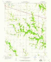
Other maps of this area

1903 · Palmyra
USGS Topo · 1:125,000

1948 · Quincy
USGS Topo · 1:250,000

1953 · Moberly
USGS Topo · 1:250,000

1954 · Moberly
USGS Topo · 1:250,000

1956 · Quincy
USGS Topo · 1:250,000

1957 · Moberly
USGS Topo · 1:250,000
1958 · Lentner
USGS Topo · 1:24,000
1959 · Shelbina
USGS Topo · 1:24,000
1959 · Lakenan
USGS Topo · 1:24,000

1960 · Moberly
USGS Topo · 1:250,000