1964 Map of Shelbyville
USGS Topo · Published 1975About this map
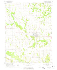
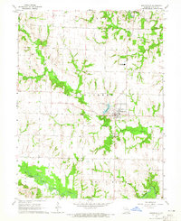
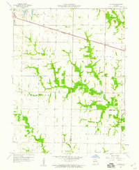
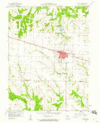
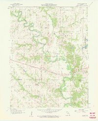
Shelbyville serves as the focal point of this mid-1960s survey, surrounded by a rural landscape defined by its winding waterways and small farming communities. The town is flanked by Black Creek to the north and east, with Shelbyville Lake and the Shelby County Airfield positioned on its western outskirts. To the north, the smaller settlements of Bethel, Mesner, and Kirby highlight a pattern of local development that relies on the surrounding agricultural townships.
Find a feature on this map
25 named features on this map. Tap any name to fly to it.
Don’t see what you’re looking for? This feature index may not catch every label — zoom into the map to look around manually.
Map Details
Editions of this 1964 Shelbyville Map
2 editions found
Other maps of this area

1903 · Palmyra
USGS Topo · 1:125,000

1948 · Quincy
USGS Topo · 1:250,000

1953 · Moberly
USGS Topo · 1:250,000

1954 · Moberly
USGS Topo · 1:250,000

1956 · Quincy
USGS Topo · 1:250,000

1957 · Moberly
USGS Topo · 1:250,000
1958 · Lentner
USGS Topo · 1:24,000
1959 · Shelbina
USGS Topo · 1:24,000
1959 · Lakenan
USGS Topo · 1:24,000

1960 · Moberly
USGS Topo · 1:250,000