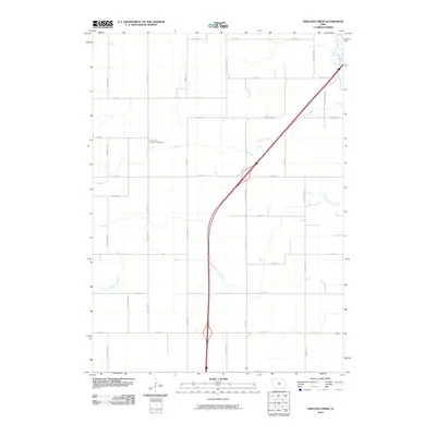
2010 Map of Sheldon Creek
USGS Topo · Published 2010About this map
Saint Pauls Lutheran Cemetery sits at the heart of this agricultural landscape in Hamilton County, a central landmark in a region defined by its productive prairie soils and engineered water management. The terrain is intricately drained by a network of waterways including Sheldon Creek and the South Fork Iowa River, along with significant channelization projects like Sheldon Ditch and Ditch Number 29. These features illustrate the intensive 20th-century efforts to reclaim wetland for row-crop farming. The map reveals a strict grid of section-line roads, such as Taylor Ave and Yankee Ave, which facilitate movement across this rural expanse. In the far northeastern corner, the Iowa River cuts through the landscape, providing a natural contrast to the straight-line precision of the surrounding ditches and township roads.
Find a feature on this map
33 named features on this map. Tap any name to fly to it.
Don’t see what you’re looking for? This feature index may not catch every label — zoom into the map to look around manually.
Map Details
Editions of this 2010 Sheldon Creek Map
This is the sole edition of this map. No revisions or reprints were ever made.
Other maps of this area

1954 · Waterloo
USGS Topo · 1:250,000

1955 · Waterloo
USGS Topo · 1:250,000

1978 · Blairsburg
USGS Topo · 1:24,000

1978 · Clarion
USGS Topo · 1:24,000

1978 · Sheldon Creek
USGS Topo · 1:24,000

1978 · Dows West
USGS Topo · 1:24,000

1978 · Clarion SW
USGS Topo · 1:24,000

1978 · Williams
USGS Topo · 1:24,000

1979 · Dows East
USGS Topo · 1:24,000

1979 · Buckeye West
USGS Topo · 1:24,000