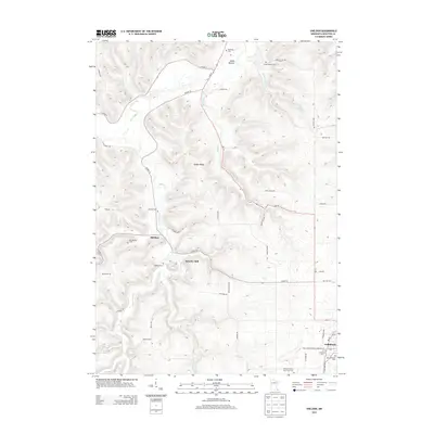
2013 Map of Sheldon
USGS Topo · Published 2013About this map
Beaver Cr and its tributaries carve a network of ridges and valleys through Houston County, anchoring the settlement of Sheldon and the industrial history at Schechs Mill. This area of southeastern Minnesota displays a landscape defined by its cemetery locations, which are often perched on high ground or tucked into valley floors, including the Old Sheldon Cem and the Houston County Poor Farm Cem. The topography influenced the early road network, with routes like Co HWY-10 and MN-76 following the contours of Hauge Ridge and Prairie Ridge Rd. In the southeastern corner, the outskirts of Caledonia emerge near the junction of MN-44, where several burial grounds, such as Evergreen Cem and Saint John's German Lutheran Cem, reflect the heritage of the local community.
Find a feature on this map
50 named features on this map. Tap any name to fly to it.
Don’t see what you’re looking for? This feature index may not catch every label — zoom into the map to look around manually.
Map Details
Editions of this 2013 Sheldon Map
This is the sole edition of this map. No revisions or reprints were ever made.
Other maps of this area

1930 · La Crescent
USGS Topo · 1:62,500

1956 · Brownsville
USGS Topo · 1:62,500

1956 · La Crescent
USGS Topo · 1:62,500

1958 · Houston
USGS Topo · 1:62,500

1958 · La Crosse
USGS Topo · 1:250,000

1961 · La Crosse
USGS Topo · 1:250,000

1965 · La Crosse
USGS Topo · 1:250,000

1965 · Wilmington
USGS Topo · 1:24,000

1965 · Spring Grove
USGS Topo · 1:24,000

1965 · Sheldon
USGS Topo · 1:24,000