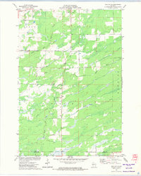
1971 Map of Sheldon NE
USGS Topo · Published 1974About this map
South Lawrence Church and its neighboring South Lawrence Cemetery serve as the community hub for this rural Rusk and Taylor County landscape. Recorded in the early 1970s, the terrain is defined by a dense network of waterways including the Jump River and Little Jump River, which converge in the southern portion of the sheet. The presence of an Old Railroad Grade and numerous Gravel Pits reflects the area's history of transport and resource extraction. Evidence of civic and safety infrastructure is visible at the Townhall and the Lawrence Lookout Tower, while the winding courses of Main Creek and Crazy Horse Creek drain the surrounding timber and wetlands. This area represents a classic northern Wisconsin settlement pattern where small community landmarks persist amidst a landscape largely reclaimed by nature and industry.
Find a feature on this map
19 named features on this map. Tap any name to fly to it.
Don’t see what you’re looking for? This feature index may not catch every label — zoom into the map to look around manually.
Map Details
Editions of this 1971 Sheldon NE Map
This is the sole edition of this map. No revisions or reprints were ever made.
Other maps of this area

1941 · Kennan
USGS Topo · 1:48,000

1945 · Kennan
USGS Topo · 1:48,000

1945 · Black River
USGS Topo · 1:48,000

1945 · Ingram
USGS Topo · 1:48,000

1947 · Ingram
USGS Topo · 1:48,000

1947 · Sheldon
USGS Topo · 1:48,000

1949 · Sheldon
USGS Topo · 1:48,000

1949 · Jump River Fire Tower
USGS Topo · 1:48,000

1953 · Rice Lake
USGS Topo · 1:250,000

1959 · Rice Lake
USGS Topo · 1:250,000