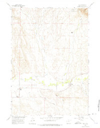
1960 Map of Shell
USGS Topo · Published 1975About this map
The small community of Shell serves as the focal point for this 1960 field-checked survey of Big Horn County, situated where the arid plains meet the foothills of the Bighorn National Forest. The landscape is defined by its sophisticated irrigation network, necessary for sustaining agriculture in this high-desert environment. Features such as the Shell High Line Canal, Kershner Ditch, and High Line Ditch demonstrate the engineering required to divert water from Shell Creek and Trapper Creek to local ranches and homesteads.
Find a feature on this map
17 named features on this map. Tap any name to fly to it.
Don’t see what you’re looking for? This feature index may not catch every label — zoom into the map to look around manually.
Map Details
Editions of this 1960 Shell Map
2 editions found
Other maps of this area

1898 · Bald Mountain
USGS Topo · 1:125,000

1901 · Bald Mountain
USGS Topo · 1:125,000

1955 · Sheridan
USGS Topo · 1:250,000

1958 · Sheridan
USGS Topo · 1:250,000

1960 · White Sulphur Spring
USGS Topo · 1:24,000

1960 · Black Mountain
USGS Topo · 1:24,000

1960 · Manderson NE
USGS Topo · 1:24,000

1960 · Hidden Tepee Creek
USGS Topo · 1:24,000

1960 · Devils Kitchen
USGS Topo · 1:24,000

1960 · Shell
USGS Topo · 1:24,000