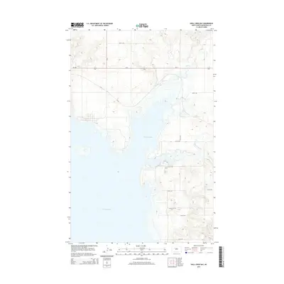
2014 Map of Shell Creek Bay
USGS Topo · Published 2014About this map
Shell Creek Bay dominates this portion of the Missouri River valley in Mountrail County, where the rising waters of Lake Sakakawea have fundamentally altered the landscape. This 2014 survey illustrates the intricate shoreline where the Van Hook Arm and Shell Cr meet the reservoir, creating a complex network of inlets and peninsulas. The modern road network, including the junction of Nd-1804 and Nd-23, reflects the regional infrastructure necessary for access in this water-defined geography. To the east, the E Fork Shell Cr cuts through the upland terrain, while names like McLean City Rd hint at historical connectivity in an area now defined by its expansive water bodies. The map provides a clear record of the interface between the rolling plains and the significant man-made aquatic features that characterize the New Town vicinity.
Find a feature on this map
17 named features on this map. Tap any name to fly to it.
Don’t see what you’re looking for? This feature index may not catch every label — zoom into the map to look around manually.
Map Details
Editions of this 2014 Shell Creek Bay Map
This is the sole edition of this map. No revisions or reprints were ever made.
Other maps of this area

1953 · Williston
USGS Topo · 1:250,000

1953 · Watford City
USGS Topo · 1:250,000

1957 · Williston
USGS Topo · 1:250,000

1957 · Watford City
USGS Topo · 1:250,000

1967 · Watford City
USGS Topo · 1:250,000

1967 · New Town SW
USGS Topo · 1:24,000

1967 · Parshall SW
USGS Topo · 1:24,000

1967 · New Town SE
USGS Topo · 1:24,000

1981 · Belden SW
USGS Topo · 1:24,000

1981 · New Town
USGS Topo · 1:24,000