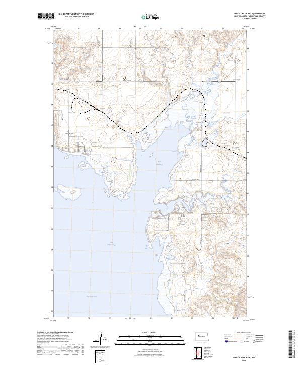
2024 Map of Shell Creek Bay
USGS Topo · Published 2024About this map
Lake Sakakawea dominates this section of Mountrail County, where the sprawling waters of the Van Hook Arm and Shell Creek Bay meet the undulating prairie landscape. The area is defined by the significant hydrological impact of the Garrison Dam downstream, which transformed the original valley of Shell Creek into a massive reservoir system. Near the northern shoreline, the Van Hook Cem remains as a poignant landscape marker of the former townsite of Van Hook, which was relocated during the mid-20th century flooding of the Missouri River valley. The surrounding terrain is characterized by intricate coulees and drainage patterns, including the East Fork Shell Creek, illustrating the complex intersection of modern water management and the region's historic topography. Section lines and rural routes like 39th St NW and 79th Ave NW provide the grid for current land use in this lakeside environment.
Find a feature on this map
18 named features on this map. Tap any name to fly to it.
Don’t see what you’re looking for? This feature index may not catch every label — zoom into the map to look around manually.
Map Details
Editions of this 2024 Shell Creek Bay Map
This is the sole edition of this map. No revisions or reprints were ever made.
Other maps of this area

1953 · Williston
USGS Topo · 1:250,000

1953 · Watford City
USGS Topo · 1:250,000

1957 · Williston
USGS Topo · 1:250,000

1957 · Watford City
USGS Topo · 1:250,000

1967 · Watford City
USGS Topo · 1:250,000

1967 · New Town SW
USGS Topo · 1:24,000

1967 · Parshall SW
USGS Topo · 1:24,000

1967 · New Town SE
USGS Topo · 1:24,000

1981 · Belden SW
USGS Topo · 1:24,000

1981 · New Town
USGS Topo · 1:24,000