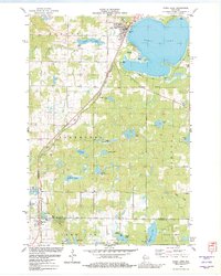
1982 Map of Shell Lake
USGS Topo · Published 1982About this map
Shell Lake dominates the northern reaches of this Wisconsin landscape, where the city of the same name sits along its western shore. The town's layout includes civic landmarks like the High Sch, Memorial Park, and the Municipal Airport, reflecting a developed community during the early 1980s. To the south, the village of Barronett anchors a more rural landscape defined by numerous water bodies like Chain Lake and Long Lake.
Find a feature on this map
47 named features on this map. Tap any name to fly to it.
Don’t see what you’re looking for? This feature index may not catch every label — zoom into the map to look around manually.
Map Details
Editions of this 1982 Shell Lake Map
This is the sole edition of this map. No revisions or reprints were ever made.
Other maps of this area

1948 · Spooner
USGS Topo · 1:48,000

1949 · Hertel
USGS Topo · 1:48,000

1949 · Spooner
USGS Topo · 1:48,000

1951 · Cumberland
USGS Topo · 1:48,000

1951 · Shell Lake
USGS Topo · 1:48,000

1953 · Rice Lake
USGS Topo · 1:250,000

1953 · Stillwater
USGS Topo · 1:250,000

1955 · Hertel
USGS Topo · 1:62,500

1955 · Stillwater
USGS Topo · 1:250,000

1956 · Cumberland
USGS Topo · 1:62,500