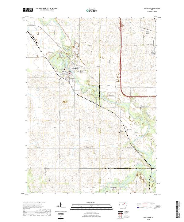
2022 Map of Shell Rock
USGS Topo · Published 2022About this map
Shell Rock sits at the heart of this landscape, its street grid organized around the winding Shell Rock River. The map documents a predominantly agricultural region across the borders of Butler, Bremer, and Black Hawk counties, where the rural sections are punctuated by small community hubs and cemeteries. Near the eastern edge, the Waverly municipal boundary and the Waverly Municipal Airport indicate the modern expansion of the nearby city toward the river valley.
Find a feature on this map
86 named features on this map. Tap any name to fly to it.
Don’t see what you’re looking for? This feature index may not catch every label — zoom into the map to look around manually.
Map Details
Editions of this 2022 Shell Rock Map
This is the sole edition of this map. No revisions or reprints were ever made.
Other maps of this area

1954 · Waterloo
USGS Topo · 1:250,000

1955 · Waterloo
USGS Topo · 1:250,000

1963 · Waverly
USGS Topo · 1:24,000

1963 · Cedar Falls
USGS Topo · 1:24,000

1971 · Shell Rock
USGS Topo · 1:24,000

1971 · Bremer
USGS Topo · 1:24,000

1971 · Coster
USGS Topo · 1:24,000

1971 · Plainfield
USGS Topo · 1:24,000

1971 · Clarksville
USGS Topo · 1:24,000

1971 · Stout
USGS Topo · 1:24,000