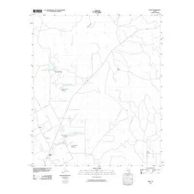
2010 Map of Shep
USGS Topo · Published 2010About this map
The community of Shep and the nearby Happy Valley anchor this landscape in Taylor County, where the terrain is defined by a sophisticated network of water management and drainage. Multiple forks of Spring Creek and Bluff Creek feed into a series of coordinated flood control structures, including Soil Conservation Service Site 14 Reservoir and Soil Conservation Service Site 11 Reservoir. These reservoirs and their associated dams represent a mid-century effort to stabilize the watershed and support local agriculture.
Find a feature on this map
34 named features on this map. Tap any name to fly to it.
Don’t see what you’re looking for? This feature index may not catch every label — zoom into the map to look around manually.
Map Details
Editions of this 2010 Shep Map
This is the sole edition of this map. No revisions or reprints were ever made.
Other maps of this area

1890 · Abilene
USGS Topo · 1:125,000

1892 · Abilene
USGS Topo · 1:125,000

1893 · Sweetwater
USGS Topo · 1:125,000

1954 · Big Spring
USGS Topo · 1:250,000

1954 · Abilene
USGS Topo · 1:250,000

1957 · Merkel
USGS Topo · 1:62,500

1957 · Buffalo Gap
USGS Topo · 1:62,500

1958 · Big Spring
USGS Topo · 1:250,000

1958 · Abilene
USGS Topo · 1:250,000
1967 · Shep
USGS Topo · 1:24,000