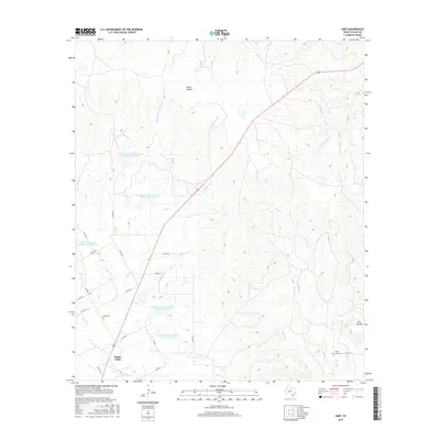
2016 Map of Shep
USGS Topo · Published 2016About this map
Shep and Happy Valley anchor the western portion of this Taylor County landscape, where the terrain transitions from the upland heights of Flat Top Mtn to the riparian corridors of Valley Cr and Bluff Cr. The region is defined by an extensive water management system, featuring several Soil Conservation Service reservoirs including Site 14 and Site 15. These man-made features contrast with natural drainage patterns like Horse Hollow and the various forks of Spring Cr. For genealogists and local historians, the map provides precise locations for the Shep Cem and Bluff Creek Cem. The settlement pattern is largely rural, connected by a network of county roads like Co RD 227 and Co RD 216 that trace the varied topography of the Texas Hill Country fringe.
Find a feature on this map
33 named features on this map. Tap any name to fly to it.
Don’t see what you’re looking for? This feature index may not catch every label — zoom into the map to look around manually.
Map Details
Editions of this 2016 Shep Map
This is the sole edition of this map. No revisions or reprints were ever made.
Other maps of this area

1890 · Abilene
USGS Topo · 1:125,000

1892 · Abilene
USGS Topo · 1:125,000

1893 · Sweetwater
USGS Topo · 1:125,000

1954 · Big Spring
USGS Topo · 1:250,000

1954 · Abilene
USGS Topo · 1:250,000

1957 · Merkel
USGS Topo · 1:62,500

1957 · Buffalo Gap
USGS Topo · 1:62,500

1958 · Big Spring
USGS Topo · 1:250,000

1958 · Abilene
USGS Topo · 1:250,000
1967 · Shep
USGS Topo · 1:24,000