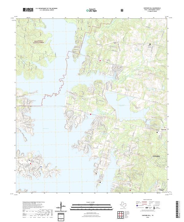
2022 Map of Shepard Hill
USGS Topo · Published 2022About this map
Sam Houston National Forest defines the northwestern reaches of this Montgomery County landscape, where the dense woodlands meet the expansive waters of Lake Conroe. The map reveals a suburban transition near the growing centers of Conroe and Willis, characterized by established residential enclaves like Panorama Village and various lakeside subdivisions. This modern survey illustrates the complex water management of the region, featuring Lewis Creek Reservoir, Calfee Lake, and Williamson Lake alongside smaller drainages like Peach Cr and Stewarts Cr.
Find a feature on this map
196 named features on this map. Tap any name to fly to it.
Don’t see what you’re looking for? This feature index may not catch every label — zoom into the map to look around manually.
Map Details
Editions of this 2022 Shepard Hill Map
This is the sole edition of this map. No revisions or reprints were ever made.
Other maps of this area

1954 · Beaumont
USGS Topo · 1:250,000

1957 · Beaumont
USGS Topo · 1:250,000

1958 · Conroe
USGS Topo · 1:24,000

1958 · Cowl Spur
USGS Topo · 1:24,000

1958 · Lake Paula
USGS Topo · 1:24,000

1959 · Moore Grove
USGS Topo · 1:24,000

1959 · San Jacinto
USGS Topo · 1:24,000

1959 · Montgomery
USGS Topo · 1:24,000

1960 · Willis
USGS Topo · 1:24,000

1960 · New Waverly
USGS Topo · 1:24,000