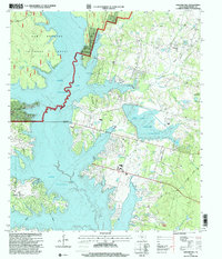
1997 Map of Shepard Hill
USGS Topo · Published 2000About this map
Sam Houston National Forest dominates the western portion of this landscape, where the waters of Lake Conroe reach into the timberlands. The survey reflects a late 20th-century mix of recreation and resource management, showing numerous named lakes such as Lake Paula, Hulon Lake, and Williamson Lake scattered throughout the piney woods. To the east, the Lewis Creek Reservoir and its associated Dike mark a significant engineering presence alongside Gunter and the outskirts of Willis.
Find a feature on this map
30 named features on this map. Tap any name to fly to it.
Don’t see what you’re looking for? This feature index may not catch every label — zoom into the map to look around manually.
Map Details
Editions of this 1997 Shepard Hill Map
This is the sole edition of this map. No revisions or reprints were ever made.
Other maps of this area

1954 · Beaumont
USGS Topo · 1:250,000

1957 · Beaumont
USGS Topo · 1:250,000

1958 · Conroe
USGS Topo · 1:24,000

1958 · Cowl Spur
USGS Topo · 1:24,000

1958 · Lake Paula
USGS Topo · 1:24,000

1959 · Moore Grove
USGS Topo · 1:24,000

1959 · San Jacinto
USGS Topo · 1:24,000

1959 · Montgomery
USGS Topo · 1:24,000

1960 · Willis
USGS Topo · 1:24,000

1960 · New Waverly
USGS Topo · 1:24,000