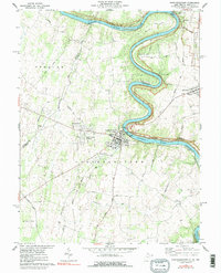
1978 Map of Shepherdstown
USGS Topo · Published 1991About this map
The Potomac River carves a dramatic serpentine path through this borderland, defining the sharp turns of Horseshoe Bend and the peninsula of Terrapin Neck. This late-1970s landscape is dominated by the historic core of Shepherdstown, where Shepherd College and the Rumsey Monument stand near the James Rumsey Bridge. The Maryland side of the river highlights the preserved infrastructure of the Chesapeake and Ohio Canal, running parallel to the water through Snyders Landing and Taylors Landing.
Find a feature on this map
58 named features on this map. Tap any name to fly to it.
Don’t see what you’re looking for? This feature index may not catch every label — zoom into the map to look around manually.
Map Details
Editions of this 1978 Shepherdstown Map
2 editions found
Other maps of this area

1884 · Harpers Ferry
USGS Topo · 1:125,000

1891 · Harpers Ferry
USGS Topo · 1:125,000

1893 · Harpers Ferry
USGS Topo · 1:125,000

1908 · Middletown
USGS Topo · 1:48,000

1909 · Hagerstown
USGS Topo · 1:48,000

1910 · Antietam
USGS Topo · 1:62,500

1912 · Hagerstown
USGS Topo · 1:62,500

1912 · Williamsport
USGS Topo · 1:62,500

1914 · Martinsburg
USGS Topo · 1:48,000

1916 · Martinsburg
USGS Topo · 1:62,500