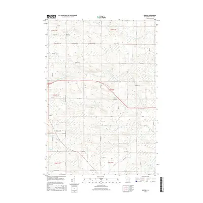
2015 Map of Shepley
USGS Topo · Published 2015About this map
The Middle Branch Embarrass River winds through this section of Shawano County, defining a landscape marked by small agricultural settlements and a dense network of country roads. The community of Shepley sits in the northern reaches, while Whitcomb and the intersection at Five Corners serve as local landmarks further south. Numerous small waterways, including Tiger Cr, Beetle Cr, and Simpson Cr, drain the terrain, illustrating the hydrological complexity of the region. The road system is particularly detailed, preserving names like School House Rd and Wittibirn Townline Rd, which suggest the historic placement of local institutions and the boundaries of early townships. This survey captures the rural character of the area, where family-named routes such as Marquardt Ln and Pingel Ln connect dispersed homesteads to the primary thoroughfares.
Find a feature on this map
66 named features on this map. Tap any name to fly to it.
Don’t see what you’re looking for? This feature index may not catch every label — zoom into the map to look around manually.
Map Details
Editions of this 2015 Shepley Map
This is the sole edition of this map. No revisions or reprints were ever made.
Other maps of this area

1954 · Wittenberg
USGS Topo · 1:48,000

1954 · Gresham
USGS Topo · 1:48,000

1955 · Clintonville
USGS Topo · 1:48,000

1955 · Tigerton
USGS Topo · 1:48,000

1955 · Green Bay
USGS Topo · 1:250,000

1964 · Wittenberg
USGS Topo · 1:62,500

1964 · Gresham
USGS Topo · 1:62,500
1970 · Tigerton NW
USGS Topo · 1:24,000
1970 · Marion
USGS Topo · 1:24,000
1970 · Tigerton
USGS Topo · 1:24,000